Forecast for Skyline Area MountainsIssued by Brett Kobernik for |
|
ANTICIPATE ELEVATED AVALANCHE DANGER THROUGH THE WEEK.
The avalanche danger is rated at CONSIDERABLE today.
Human triggered avalanches 1 to 3 feet deep are likely.
The most likely places to trigger an avalanche are on mid and upper elevation slopes steeper than 30˚ that face west through north through southeast.
Upper elevation steep slopes that face north through east are especially dangerous.
|
|
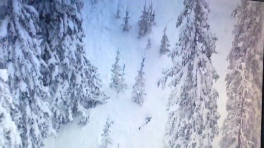
Current Conditions: Around a foot of new snow accumulated over the last 24 hours. It looks like the northern half of the Skyline did slightly better than the southern end. It’s still snowing as of 7:00am and the snow level finally dropped to the valley recently. Ridgetop wind has been from the southwest and has been in the moderate speed category with some stronger gusts. It’s been strong enough to drift snow in the higher terrain. Temperatures started out very warm with this storm. It rained up to around 8000′, and briefly to 8500′. Temperatures have been gradually cooling and are in the mid 20s this morning.
Mountain Weather: We should see periods of snow today and tonight with a few more inches of accumulation possible. Wind will shift and blow from the northwest with moderate speeds. Temperatures will gradually cool later on today. We have a break in the action for Thursday and a more significant storm still on track for Friday and into the weekend.
|
General Announcements
This forecast is from the U.S.D.A. Forest Service, which is solely responsible for its content. This forecast describes general avalanche conditions and local variations always occur.