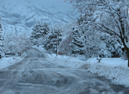
SALT LAKE CITY (AP) — The first of two Pacific storm systems is moving across Utah with the stronger storm expected to descend from the northern mountains with the heaviest snow early Friday and intensifying as it spreads south Saturday.
A winter weather advisory remains in effect until 6 p.m. Thursday for areas mostly north of I-80. A winter storm warning goes into effect at midnight Thursday through noon Saturday.
As much as 20 inches of snow is possible late Friday and early Saturday in the upper elevations of the Wasatch mountains with winds gusting up to 50 mph.
Heavy snow is forecast for the Wasatch Front early Saturday with minor slushy accumulations to the valley floors.
Kodachrome Basin State Park east of Cedar City set a record-low temperature of 7 degrees early Thursday, breaking the old record of 8 set in 1988.